Suspension Bridges Crossing Carroll Creek
This is a list of all 2 bridges from the suspension bridge inventory crossing Carroll Creek. Please note that different rivers with the same name will be grouped together. For example, selecting 'Bear Creek' shows bridges across several different Bear Creeks. Also, similarly named rivers are grouped separately. For example, 'River Dee' (UK) bridges are grouped separately from 'Dee River' (Australia) bridges. Wherever you see a Bridgemeister ID number click it to isolate the bridge on its own page.
Related Lists:
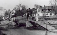
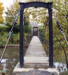
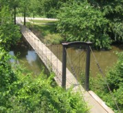
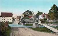
1885: Swinging
Frederick, Maryland, USA - Carroll Creek
| Bridgemeister ID: | 253 (added before 2003) |
| Year Completed: | 1885 |
| Name: | Swinging |
| Location: | Frederick, Maryland, USA |
| Crossing: | Carroll Creek |
| At or Near Feature: | Baker Park |
| Coordinates: | 39.415033 N 77.4208 W |
| Maps: | Acme, GeoHack, Google, OpenStreetMap |
| Principals: | Buckey and Firestone |
| Use: | Footbridge |
| Status: | In use (last checked: 2022) |
| Main Cables: | Wire |
| Suspended Spans: | 1 |
Notes:
- Local legend states this bridge was used by Stonewall Jackson and his troops when they entered Frederick on September 10, 1862. Some sources state the bridge was constructed in 1875. The Maryland Inventory of Historic Properties states it was constructed in 1885 and includes a detailed chronology of the events of 1885 leading to its construction.
- c. 1928: The bridge is relocated from Bentz Street (then Mill Alley) to nearby Baker Park. Some sources indicate it was relocated twice to different locations within Baker Park).
- 2008, March: Closed due to safety concerns. Eventually reopened.
- Near 2006 William O. Lee (Carroll Creek Park) - Frederick, Maryland, USA.
External Links:
- Baker Park - Maryland Historic District. States bridge was built in 1875.
- Maryland Inventory of Historic Properties - Swinging Bridge
- Bridgehunter.com - BH63316
- Structurae - Structure ID 20011117
Image Sets:
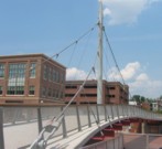
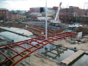
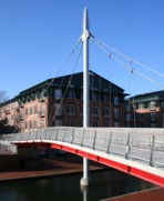
2006: William O. Lee
Frederick, Maryland, USA - Carroll Creek
| Bridgemeister ID: | 2088 (added 2006-07-01) |
| Year Completed: | 2006 |
| Name: | William O. Lee |
| Also Known As: | Carroll Creek Park |
| Location: | Frederick, Maryland, USA |
| Crossing: | Carroll Creek |
| Coordinates: | 39.412783 N 77.409267 W |
| Maps: | Acme, GeoHack, Google, OpenStreetMap |
| Principals: | HNTB Corp. |
| Use: | Footbridge |
| Status: | In use (last checked: 2019) |
| Main Cables: | Wire (steel) |
| Suspended Spans: | 2 |
| Side Spans: | 2 x 18.11 meters (59.4 feet) |
Notes:
External Links:
Image Sets:
Do you have any information or photos for these bridges that you would like to share? Please email david.denenberg@bridgemeister.com.
Mail | Facebook | X (Twitter) | Bluesky